Mappe Tattili
Mappa Alta Valle Cervo
Cosa fare da noi, in Valle Cervo
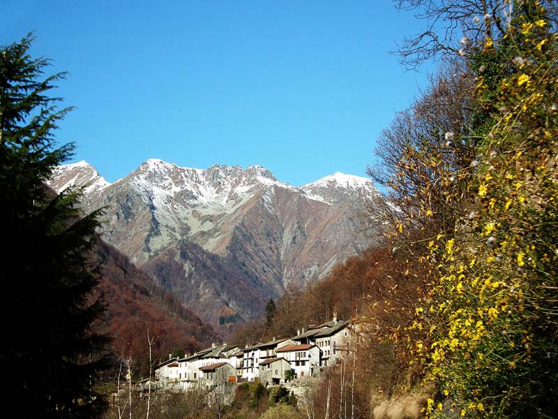
ALTA VALLE CERVO
La mappa rappresenta sinteticamente le principali strade, corsi d’acqua e insediamenti dell’Alta Valle Cervo, nella provincia di Biella.
Segni convenzionali
-
La linea continua indica la strada provinciale e le sue diramazioni;
-
la linea zigrinata rappresenta i corsi d’acqua, prevalentemente il torrente Cervo;
-
le crocette sono gli insediamenti abitati, con i nomi ;
-
il pallino è il santuario di San Giovanni d’Andorno, con la scritta “Santuario”;
-
i rettangoli pieni sono la Galleria di Rosazza e il Santuario di Oropa, anch’essi indicati dalle relative scritte.
Tutte le scritte sono in nero e in braille.
Introduzione
Orientiamo la mappa con l’angolo tagliato in alto a destra. In alto a sinistra troviamo così la scritta “Alta Valle Cervo”. Il nord è in alto.
Se percorriamo il foglio a due mani in diagonale, dall’angolo in basso a destra a quello in alto a sinistra, non faremo fatica a seguire, ignorando per ora gli altri segni, una linea zigrinata: è il torrente Cervo, affiancato dalla linea continua della strada provinciale, e che in questo momento stiamo percorrendo controcorrente.
Il torrente infatti nasce dal Lago della Vecchia, a 1858 metri sul livello del mare sulle Alpi Biellesi, e scorre verso sud-est in maniera abbastanza precipitosa fino a confluire nel Sesia, nei pressi di Vercelli. Intorno al suo ampio alveo si sviluppa l’omonima Valle Cervo, che nella sua parte alta è caratterizzata da lussureggianti faggete e, talvolta, speroni di roccia granitica.
Legno e pietra sono le risorse alla base di molte attività artigianali ed industriali della zona che, assieme all’industria tessile, ne definiscono gli abitati: sono comuni infatti le murature in pietra naturale così come le piccole fabbriche, soprattutto in direzione della pianura, scendendo verso Biella.
La natura remota e protetta della valle, inoltre, ha favorito la nascita di santuari e luoghi di culto nel corso dei secoli, tra cui il Santuario di San Giovanni Battista, in cui si trova proprio la Locanda del Santuario.
Da Oropa a Rosazza
Portiamo le mani nell’angolo in basso a sinistra della mappa. Troveremo la scritta “Oropa” e, alla sua destra, un piccolo quadrato a rilievo. Questo indica il celebre Santuario dedicato alla Madonna Nera: il vasto complesso è nato su un luogo di culto precristiano, legato a degli enormi massi, e cresciuto nel corso dell’ultimo millennio. Circondato dalle montagne e fortemente caratterizzato dalle sue monumentali espansioni seicentesche, è teatrale punto di arrivo di vari cammini, ma anche spesso di una tappa del Giro d’Italia.
Se spostiamo il dito a nord del quadratino possiamo seguire la sinuosa linea della strada che, per movimentati tornanti (che ad un certo punto svoltano verso sud prima di riprendere il nord!), ci porta dai 1159 metri del santuario ai vertiginosi 1488 sui quali si apre la Galleria di Rosazza, che troviamo indicata con un altro rettangolino a rilievo che incontrerà il nostro dito lungo la strada, poco a nord-est della nostra partenza. Alla sua destra troviamo la scritta “Galleria”.
Come suggerisce il nome, la galleria collega Oropa con il paese di Rosazza. Ma c’è un altro Rosazza in questa storia: il senatore del Regno Federico Rosazza, nativo dell’omonimo paese, che a fine Ottocento ha fortemente voluto e finanziato la galleria anche grazie alla sua passione per l’occultismo. A detta sua, fu infatti consigliato dagli spiriti per quanto riguarda il tracciato della strada! La stretta ed effettivamente suggestiva galleria, scavata nella roccia che spunta dalle ruvide pareti, sfocia poi su un tratto di strada fortemente panoramico, immerso nel verde lungo i ripidi costoni della montagna.
Continuando a seguire la linea verso nord, infatti, ne noteremo la rinnovata tortuosità: ci apparirà ogni tanto quasi raggomitolata. Ad un certo punto sulla sua sinistra incontreremo un pallino. Questo è il Santuario San Giovanni d’Andorno, come indica anche la scritta “Santuario” alla sinistra del pallino. Ed è proprio qui che si trova la Locanda del Santuario!
In realtà il Santuario vero e proprio è lungo la strada, ma per esigenze di spazio il pallino è spostato leggermente a nord-ovest, dove si trova parte dell’abitato di Ospizio San Giovanni ed altri luoghi di culto collegati. Anche questo santuario, dedicato a San Giovanni Battista, è frutto di un lungo lavoro di ampliamenti e ricostruzioni che dall’inizio del Seicento arrivano ai giorni nostri. Con la sua chiesa, il ristorante ed il rifugio è da sempre un importante punto di riferimento per la comunità locale.
Passato il santuario, continuiamo a seguire la strada nella direzione generale nord-ovest e, dopo poco, noteremo che sulla destra comincia a costeggiarla la linea zigrinata del torrente Cervo: siamo arrivati al fondovalle!
Pochissimo più in su, muovendo il dito a destra e sinistra dovremmo sentire un bivio nella strada: se proseguiamo verso est, ci accorgeremo che attraversa il torrente. Noi proseguiamo invece verso ovest spingendoci poco oltre la strada, dove troveremo la crocetta che ci indica il paese di Rosazza (la scritta è sulla sinistra).
Anche qui c’è lo zampino dell’omonimo senatore che, sempre a fine Ottocento e secondo i progetti dell’amico e architetto Giuseppe Maffei, ha avviato un progetto di ampliamento urbanistico del paese che ha così ottenuto lo stato di comune nel 1906. Tra le tante edificazioni suggestive, segnate ancora una volta dall’interesse per lo spiritismo dei due, troviamo addirittura un castello neogotico e un tempio con numerosi simboli massonici ed esoterici.
Da Piedicavallo verso Biella
Torniamo alla nostra scritta “Alta Valle Cervo” in alto a sinistra. Se portiamo le dita verso il basso dovremmo incontrare la scritta “Piedic.”, e poco più giù la crocetta a cui si riferiscono, che indica appunto il paese di Piedicavallo. È il comune più settentrionale della Valle Cervo, caratterizzato dalle sue costruzioni in pietra e dall’emigrazione stagionale dei suoi abitanti per lavorare nell’edilizia, che fino al secolo scorso ha apportato grande vitalità alla cultura locale.
Sotto la croce troviamo nuovamente la strada provinciale (linea continua) e il torrente Cervo (linea zigrinata), lungo il quale si sviluppano gli altri abitati della valle. Seguiamoli verso sud-est, assecondando il corso delle acque, fino al punto in cui la strada attraversa il torrente in direzione sud: se da qui risaliamo verso l’alto in linea retta troveremo una crocetta e, alla sua destra, un’altra linea zigrinata. Questi sono rispettivamente la pittoresca frazione di Montesinaro, punto di partenza per molte escursioni, e il rio Valdescola, che porta le sue acque al Cervo. Alla destra del rio troveremo la scritta “Montesinaro”.
Scendiamo il rio fino alla confluenza e torniamo sulla provinciale, seguendola lungo il Cervo verso sud-est e arriviamo di nuovo al bivio che sta alla destra della crocetta di Rosazza: se proseguissimo verso sud, riprenderemmo la strada per Oropa. Attraversiamo invece il torrente verso est e troveremo subito un altro bivio.
Se ci scostiamo dalla biforcazione verso destra troveremo la crocetta che indica Forgnengo ( appena sopra al simbolo), frazione del comune di Campiglia Cervo ed altra località prediletta per avviarsi lungo sentieri montani. La strada su cui si trova, che si può seguire tortuosamente in direzione generale sud-est, attraversa diverse valli boscose e nella nostra rappresentazione termina al piazzale Erica, parcheggio da cui si può accedere ad alcuni sentieri (appena sopra alla scritta “Oriom.”, località che però è altrove).
Torniamo invece al bivio appena a ovest della crocetta di Forgnengo, riprendendo la provinciale di fondovalle che continua a svilupparsi lungo il torrente Cervo, ora sulla sua sinistra ovvero, nella nostra mappa, a destra della linea zigrinata: la sinistra e la destra di un corso d’acqua sono infatti intese rispetto al suo senso di scorrimento, che qui ricordiamo è verso sud-est. Procediamo quindi in questa direzione, e sfioreremo presto una crocetta. Questo è il principale abitato di Campiglia Cervo (il nome non è indicato per ragioni di spazio), da cui diparte un sentiero (anch’esso non indicato) che attraversa il torrente e porta proprio al Santuario di San Giovanni d’Andorno, che ricade infatti in territorio comunale.
Riprendiamo la strada lungo il Cervo finché non sentiremo un altro bivio con una linea più sottile, che si scosta dalla provinciale e continua alla sua destra. È la strada per Quittengo, frazione di Campiglia Cervo che è indicata da una crocetta che troviamo dopo poco (sempre con il nome non indicato). Appena a sud-est di questa crocetta ne abbiamo un altra: è l’abitato di Oriomosso (“Oriom.”, sulla destra).
Oriomosso è una piccolissima frazione sempre di Campiglia Cervo che conta 19 anime (nove femmine e dieci maschi) ed è molto ripida: inerpicata intorno ai 1000 metri di altitudine, tra la sua casa più bassa e quella più alta abbiamo ben trecento metri di dislivello! Da qui abbiamo una prospettiva panoramica su tutta l’Alta Valle Cervo in direzione nord, incorniciata dalle Alpi.
Se ci spostiamo a sinistra della crocetta troveremo una linea avvoltolata, che sono i tornanti che ci riporteranno sulla strada di Quittengo. La stessa, dopo qualche peripezia in direzione generale sud-est, nord-est e di nuovo sud, si ricollega alla provinciale affiancata al torrente Cervo. Se continuiamo a discenderla, arriveremo all’angolo in basso a destra della nostra mappa: proseguendo da qui lasciamo l’Alta Val Cervo, alla volta di Biella e poi della pianura.
UPPER CERVO VALLEY
The map synthetically represents the main roads, watercourses and settlements of the Upper Cervo Valley in the province of Biella.
Conventional signs
-
The solid line represents the provincial road and its branches.
-
The hatched line represents watercourses, mainly the Cervo River.
-
The crosses mark towns and villages, with their respective names.
-
The small circle represents the Sanctuary of San Giovanni d’Andorno, with the label “Santuario”.
-
The solid rectangles represent the Rosazza Tunnel and the Sanctuary of Oropa, also with their respective labels.
All the labels are in large-print and braille
Introduction
Place the map with the cut corner on the top right. In the top left, you will find the text “Alta Valle Cervo” (“Upper Cervo Valley”, in Italian). The geographical North is at the top.
If you run your fingers diagonally from the bottom right corner to the top left, only following the hatched line for now, you will easily track the course of Cervo River. We are currently moving upstream along the river. The Cervo River originates from Lake della Vecchia, at 1,858 meters above sea level in the Biellese Alps, and flows southeast until it joins the Sesia River near Vercelli. The Upper Cervo Valley, surrounding the stream’s wide riverbed, is covered in lush beech forests and, occasionally, granite rock formations.
Wood and stone are the materials sustaining many of the local crafts and industries in the area and which, along with the textile industry, leave a strong imprint on the settlements,. Houses in rough stone masonry and small factories dot the landscape, especially in the direction of the plain as one descends towards Biella.
The remote and secluded nature of the valley has also led to the creation of sanctuaries and places of worship over the centuries, including the Sanctuary of San Giovanni Battista, where you will find the Locanda del Santuario.
From Oropa to Rosazza
Place your hands in the bottom left corner of the map. You will find the text “Oropa” and, to its right, a small raised square. This represents the famous Sanctuary dedicated to a Black Madonna. The vast complex was built on a pre-Christian place of worship, associated with certain large rocks, and has grown over the past millennium. Surrounded by mountains and shaped by its monumental 17th-century expansions, it serves as the dramatic end point of various pilgrimages and is often part of the “Giro d’Italia” bicycle route.
If you move your finger north of the square, you can follow the winding road that leads to Oropa through a series of hairpin turns (at one point, it sharply swerves south before resuming north). This road takes you from the sanctuary at 1,159 meters to the dizzying height of 1,488 meters, where the Rosazza Tunnel is located, represented by another raised rectangle you’ll encounter on the road, slightly northeast of your starting point. To the right of the rectangle, you’ll find the text “Galleria”.
As the name suggests, the tunnel connects Oropa to the town of Rosazza. But there is more to this story: Senator Federico Rosazza, a native local, strongly supported and financed the tunnel’s construction in the late 19th century, partly due to his interest in the occult. According to him, the spirits advised him on what the road’s layout would have to be! The narrow tunnel, carved into rocks that protrude from the rugged walls, leads to a highly scenic stretch of road, immersed in lush greenery along the steep mountain slopes.
Continuing to follow the line northwards, you’ll notice it is once again meandering, at times almost coiling onto itself. At one point, on its left, you’ll encounter a small circle. This is the Sanctuary of San Giovanni d’Andorno, as pointed out by the text “Santuario” to the left of the circle. And this is precisely where you’ll find the Locanda del Santuario!
In reality, the actual sanctuary is located on the length the road, but for the sake of space and legibility the circle is slightly northwest, where part of the Ospizio San Giovanni settlement and other associated places of worship are located. This sanctuary, dedicated to San Giovanni Battista, has undergone extensive renovations and reconstructions since the beginning of the 17th century. With its church, restaurant and lodgings, it has always been an important point of reference and gathering for the local community.
After moving past the sanctuary, keep following the road in the northwest direction and, after a short while, you’ll notice the Cervo River’s hatched line on your left: you’ve reached the valley floor!
A little further up, by moving your finger to the right and left, you should feel a road junction. If you continue east, you’ll notice that it crosses the river. Instead, continue west, just beyond the road, where you’ll find the cross corresponding to the town of Rosazza (the label is to the left).
Here too, Senator Rosazza’s influence is felt. In the late 19th century, he initiated an urban expansion project based on the plans of his friend and architect Giuseppe Maffei, which led to the town obtaining city status in 1906. Among the many impressive buildings, still shaped by the two friends’ shared interest in spiritualism, one can even find a neo-Gothic castle and a temple with several Masonic and esoteric symbols.
From Piedicavallo to Biella
Let’s go back to the text “Alta Valle Cervo” in the top left corner. If you move your fingers downward, you should encounter the text “Piedic.”, and a bit further down, the cross that marks the town of Piedicavallo. It is the northernmost municipality in the Cervo Valley, characterized by its stone buildings and the seasonal migration of its inhabitants to take up construction jobs outside the Valley, which until the last century greatly influenced the local culture.
Below the cross, you’ll find the provincial road (solid line) and the Cervo River (thatched line), along which the other settlements in the valley are located. Follow both lines southeast, downstream, until you reach the point where the road crosses the river heading south. If you continue upward in a straight line from here, you will find a cross and, to its right, another hatched line. These are respectively the picturesque hamlet of Montesinaro, a starting point for many excursions, and the Valdescola stream, which feeds into the Cervo River. To the right of the stream, you’ll find the label “Montesinaro”.
Follow the stream to the confluence and go back on the provincial road, following it along the Cervo River back to the point where the road crosses the river to the south. If you cross the river and move a bit further, you’ll find another junction.
If you move away from the fork to the right, you’ll find the cross indicating Forgnengo (label just above the symbol), a hamlet in the municipality of Campiglia Cervo and another location of choice to embark on mountain trails. The road it’s located on, which you can follow southeast, snakes through various wooded valleys and in our representation ends at Piazzale Erica, a parking area that provides access to several trails (just above the text “Oriom.”, which is however somewhere else).
Instead, return to the junction just west of the Forgnengo cross, resuming your journey along the low-lying provincial road that continues along the Cervo River. This time, it is on the left bank, or in our map’s representation, to the right of the hatched line. Proceed in this direction, and you’ll soon encounter another cross. This is the main settlement of Campiglia Cervo (the name does not appear for want of space), from which a path (also not portrayed) leads to the Sanctuary of San Giovanni d’Andorno, which in fact falls within the municipal territory.
We resume our journey down the Cervo River until we feel another junction marked by a thinner line, which departs from the provincial road and continues to the right. This is the road to the village of Quittengo, part of Campiglia Cervo, marked by a small cross that we find shortly afterward (though the name is not specified). Just southeast of this cross, we have another one: it’s the village of Oriomosso (“Oriom.,” text on the right).
Oriomosso is a tiny hamlet, also part of Campiglia Cervo, with a population of 19 (nine women and ten men), and it is quite steep. Perched at around 1000 meters above sea level, there are three hundred meters between its lowest and highest houses! From here, a panoramic spot looks out on the entire Upper Cervo Valley to the north, framed by the Alps.
If we move to the left of the cross, we will find a winding line, which represents the switchback that will lead us back to the road to Quittengo. After a few twists and turns in the general directions of south-east, north-east, and again south, we eventually rejoin the provincial road alongside the Cervo River. If we continue our descent, we will arrive at the bottom right corner of our map. Continuing from this point, we would leave the Upper Cervo Valley behind, heading towards Biella, and then on to the plains.
Dal nostro blog
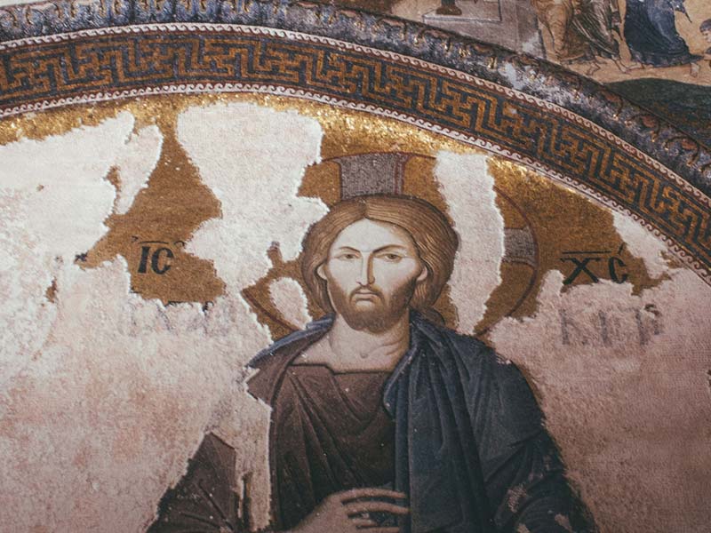
I signori della Chiesa di Santa Maria di Pediclosso
La famiglia Savoia cura la Chiesa di Santa Maria di Pediclosso con l'arte della muratura da più di 50 anni Poco distante da noi, su un sentiero che in primavera si tinge di tutti i colori del verde e d'autunno di arancio, sorge Santa Maria di Pediclosso, la chiesa più...
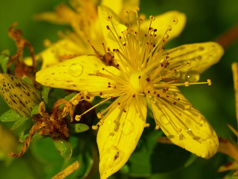
I fiori di montagna: l’erba magica di San Giovanni
A passeggio per i sentieri della Valle Cervo per raccogliere l'iperico, una dellepiante officinali più famose, in uso da oltre 2000 anni. Le donne, una volta, lo sapevano. C'è un'erba che porta il nome del Santo a cui è dedicato il nostro Santuario che...
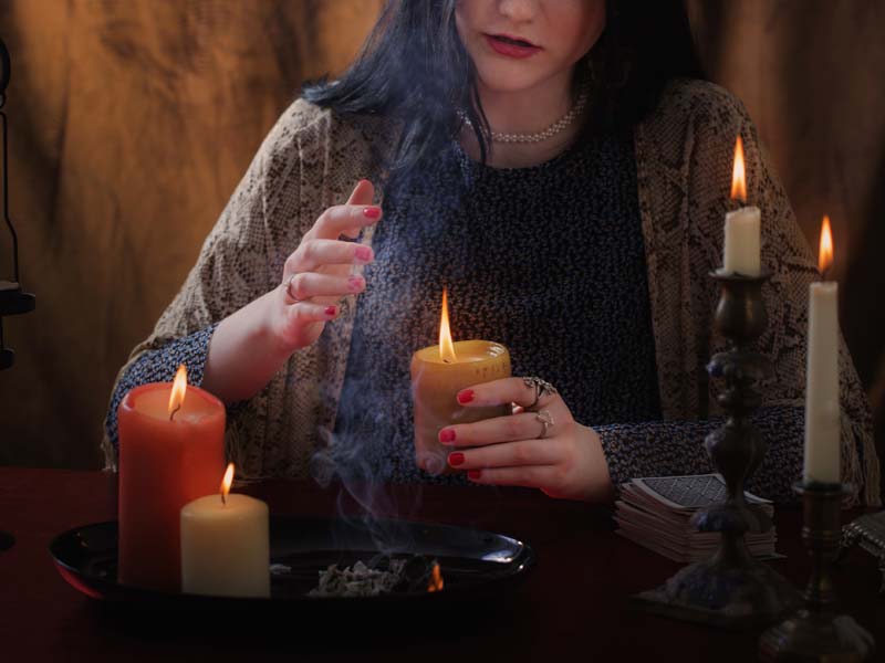
Giovanna – La strega di Miagliano
Si chiamava Giovanna de Monduro e non era come le altre. Non lo fu mai, fino alla fine. Troppo ribelle, maleducata, volubile per i suoi tempi. Strega la definirono e, come tale, la bruciarono in una notte d'estate del 1471. Nata a Miagliano, seguì il marito...
I tre rifugi facili in Valle Cervo
In Valle Cervo ci sono posti speciali, balconi che osservano dall'alto la pianura e che sono considerati dei piccoli paradisi sospesi tra cielo e bosco. Li puoi raggiungere a piedi, su sentieri fatti di pietra, protetti da una vegetazione ancora incontaminata che...
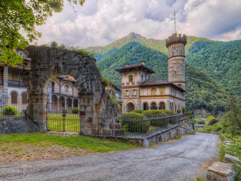
Castello di Rosazza – Il borgo più misterioso d’Italia
Cosa vedere a Rosazza Le tue prossime vacanze in Valle Cervo dovrebbero proprio passare da questo splendido borgo montano; per questo motivo scopriremo insieme a te in questo articolo cosa vedere a Rosazza. Se...
Vuoi scoprire tutte le attività e sei impaziente di avere tutte le info?
Nei dintorni
Se hai un po’ di tempo, scopri anche queste attività nei dintorni:


Siamo un ristorante escursionistico che si trova all'interno del Santuario di San Giovanni d'Andorno, in Alta Valle Cervo (Piemonte), tra le Alpi Biellesi.
Amiamo la natura e questo territorio e crediamo che la montagna debba essere per tutti, con un turismo sostenibile e accessibile. Ci impegnamo ogni giorno per far conoscere la nostra valle e i suoi prodotti enogastronomici.
Contatti
Telefono 015 60319
Dove Siamo
Frazione San Giovanni, 8
13812 Campiglia Cervo (Biella)
Scrivici
info@locandadelsantuario.it